A POWERFUL MAPPING TOOLSET FOR COMMUNITIES
MAPEO IS A FREE DIGITAL TOOLSET FOR DOCUMENTING, MONITORING AND MAPPING MANY TYPES OF DATA.
MONITOR AND DOCUMENT THE WORLD AROUND YOU
MAPEO IS A FREE DIGITAL TOOLSET FOR DOCUMENTING, MONITORING AND MAPPING MANY TYPES OF DATA.

MAPEO is an offline-first open-source technology which makes it easy for many to use. No internet or special hardware required to collect, view, or share data.
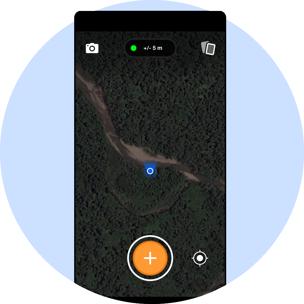
With the push of a button, contributors can gather map data by linking GPS points, photos, and notes. All data is completely owned by the communities themselves. And a simple and adaptive interface makes it accessible for many different people to use.

Communities stay organized and manage documented evidence. Data can be shared between project collaborators with MAPEO's mobile-to-mobile sync feature.
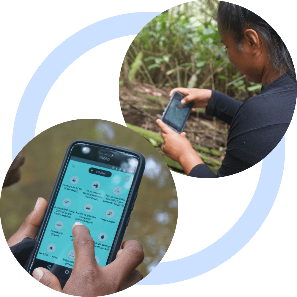
We are building MAPEO in close collaboration with indigenous partners in the Amazon, including Achuar, Cocama, Harakbut, Kofan, Kichwa, Matsiguenka, Siekopai, Wapichana, Waorani and Yine peoples. For more on Digital Democracy's partners, visit our partnership page.
The development of MAPEO has been made possible due to generous grants from the Leonardo DiCaprio Foundation, Knight Foundation, Abundance Foundation, All Eyes on the Amazon (Dutch Postcode Lottery), and Samsung Next Zero.